El mayor humedal del Mediterráneo se encuentra en la Laguna de Venecia (Italia). Está compuesto principalmente por marismas. Gracias a las crecidas de las mareas, que aportan la cantidad justa de nutrientes, agua y oxígeno con cada marea, estas marismas se encuentran entre los ecosistemas más productivos del mundo. El resultado es la colorida hierba que puedes ver en la foto.
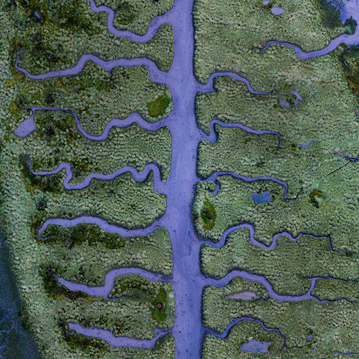
Marisma salada, España
Esta floreciente marisma cerca de La Coruña, España, está situada en el extremo de la ría de Betanzos. Hasta el siglo XVIII, el puerto de Betanzos fue un importante centro pesquero y comercial. Las singulares formas de éste fueron posiblemente influenciadas por los estanques de pesca hechos por el hombre que cubrían la zona hace siglos. Se supone que están influenciadas por una actividad realizada por el hombre porque sólo aparecen en una parte pequeña de la marisma.
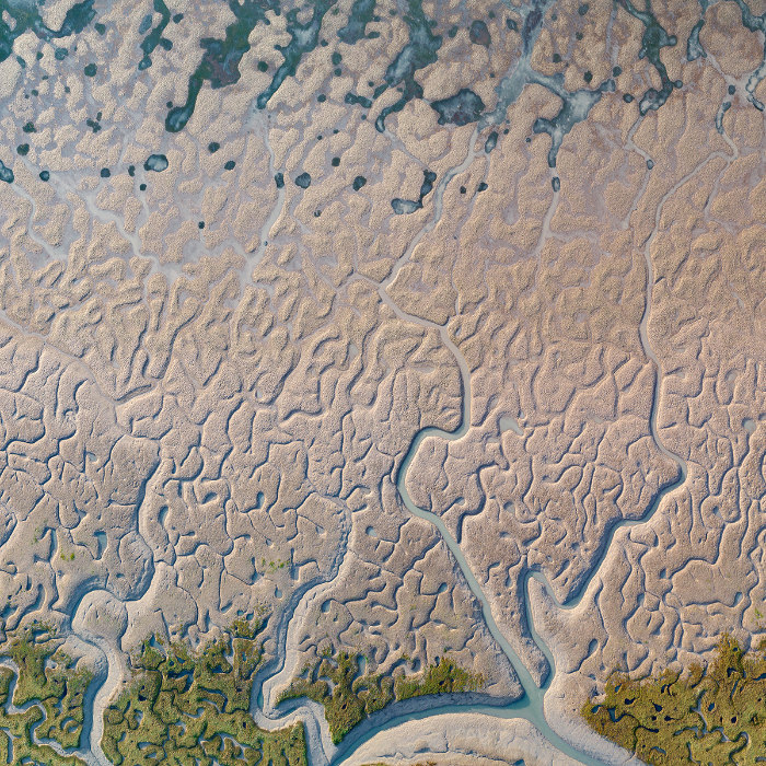
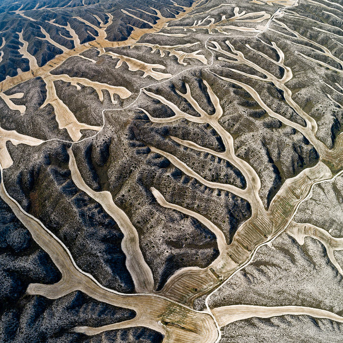
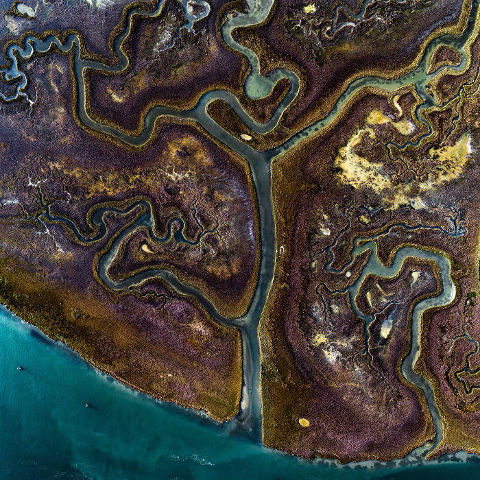
Formas de arena, España
These sand shapes are located over a large estuary of Cadiz Bay. These muddy plains are created by a naturally occurring salt marsh. The influences of the sea and time are what characterize this special area of contact between marine and terrestrial zones. With sufficient lighting, these meandering shapes are revealed by the low tide twice.
Lava Flow and Sea, Iceland
This colorful clash point between yellow and blue is caused by a mix of natural sediments. About 9,000 years ago, in a volcanic eruption, lava traveled 87 miles (140 km) to the sea until it reached the Atlantic Ocean. The yellow ones are derived from farmlands and are carried on small streams, while the blue ones are created by lava flow. They are all part of the Bjórsárum in South Iceland, which is the world’s greatest lava flow covering 376 square miles (975 square km).
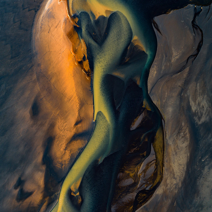
Estuary of River Affall, Iceland
Affall is a now a small, clear spring water stream. It used to connect with the Markarfljót River, resulting in somewhat glacial colors, but the connection was blocked a few years ago. What we can see in the photo above is the meeting point of the Affall river with the Atlantic Ocean over the characteristic black sand of Iceland.
Wheat Field on Former Wetland, Spain
The slopes in the photo above are all that's left from a former wetland. What's left of the dried streams are the farmlands, which the farmers plant and sow following the shape of formerly flowing water. This soil is extremely fertile and retains its moisture even during the summer months, which is exceptionally economical to the farmers, given that this is the driest area in Spain. The farmers put up stone barriers on the main branch of land to prevent it from sloping.
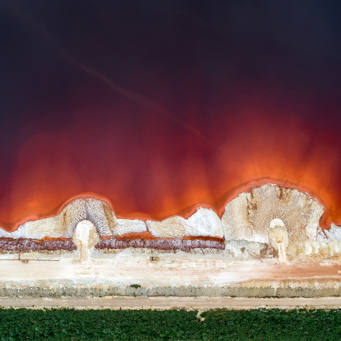
Red Mud Storage Pond, Spain
Can you spot the yellow bulldozer? If you did, you can see how small it appears, which should give you perspective on just how vast the area is.
The vehicle is bulldozing red mud, sometimes referred to as bauxite residue. Water.Shapes.Earth describes it as "a highly alkaline waste product composed mainly of iron oxide that is generated in the industrial production of aluminum oxide." Up until 2015, this residue was disposed of in estuaries, rivers, and the sea. Nowadays, the bulldozers work around the clock, including on weekends, to shovel up artificial ponds and create artificial shores on the dam where the red mud is produced.
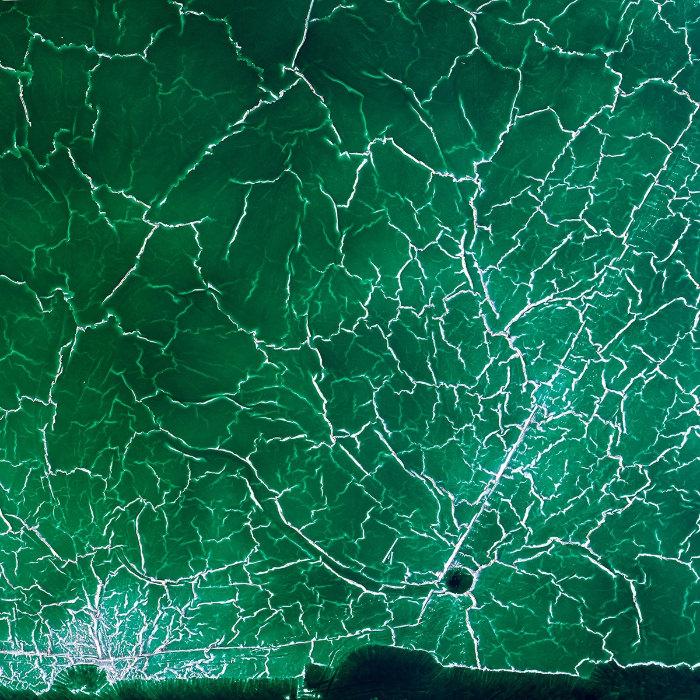
Salt Lake Mirzaladi, Azerbaijan
This salt lake spans across 3 square miles (10 square km). Salt production has begun here in 1813 by natural evaporation. Once enough salt crystals accumulate, they are harvested by raking. Since the area is not regulated, by the end of the summer season, some locals collect leftover salt by themselves using trucks. But these trucks damage the protective mud layer, which is essential for the maintenance of the microbiological balance. If you look closely, you can spot a truck on the left side of the photo.
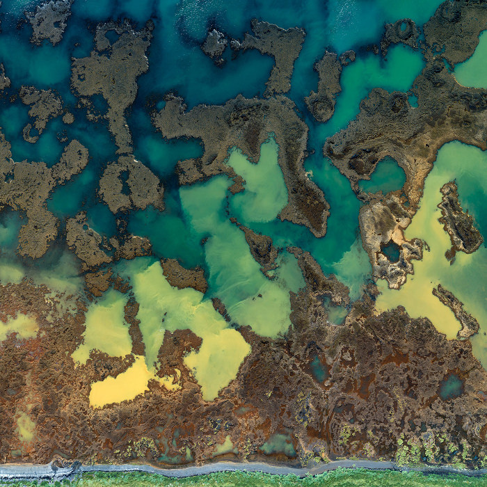
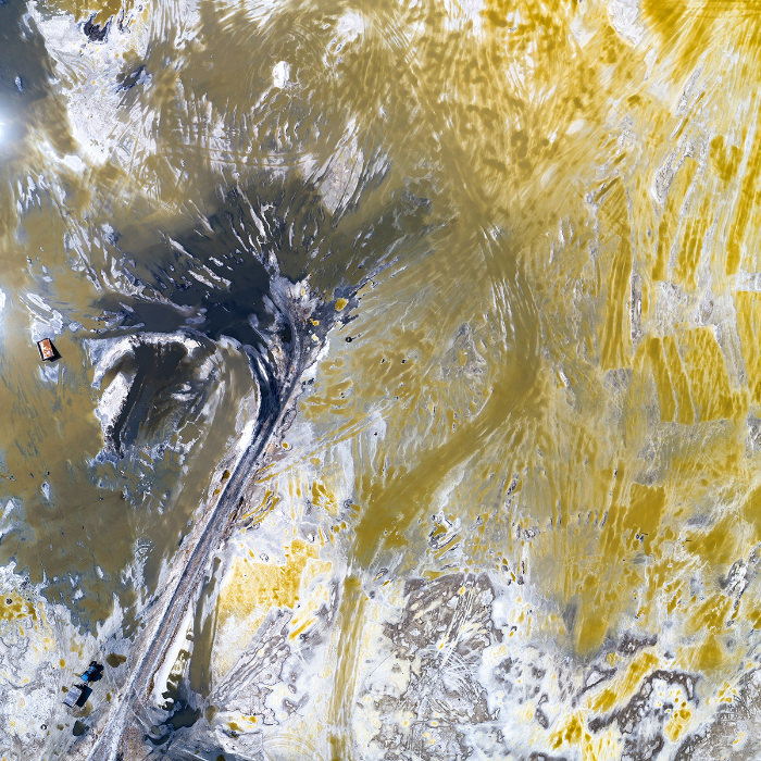
Radioactive Water, Spain
What you see in this picture is an abandoned pond once used for the disposal of phosphogypsum. This is a by-product of fertilizer production. This dam stores 120 million tonnes of phosphogypsum and is considered the largest landfill of its kind in Europe.
There is a shallow layer of radioactive water over the phosphogypsum sediments due to the uranium and thorium present naturally in phosphogypsum. The company responsible for the phosphogypsum production left the area after 43 years of work, leaving this dam behind.
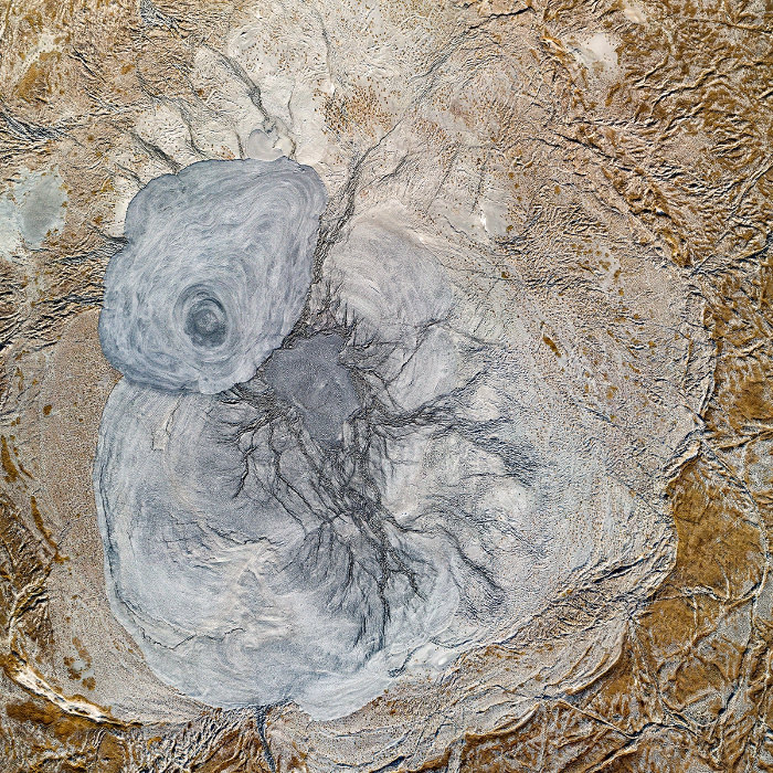
Mud Volcano Crater, Azerbaijan
Have you ever heard about mud volcanoes? They are eruptions of mud, water, and gas from inside the earth. They occur when hot water that's been heated below the ground mix with subterranean mineral deposits, creating a flow of mud. They are smaller and much less hot than lava volcanoes. There are about 700 of them on Earth. This crater beautifully displays layers of eruptions from past decades. The entire formation is 3 miles (5 km) wide and only about 100 feet (30 meters) high.
 Fuente